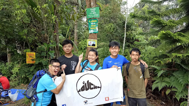
Gunung Angsi is located at Seremban.
There are 2 routes to reach the peak (from what I read on other hikers' blog) - Bukit Putus and Ulu Bendul.
The distance from entrance to peak is around 4km for Bukit Putus and around 7km for Ulu Bendul.
For this time, we chose the shorter and easier route (or so we thought) as we are all recovering from the SCKLM 2016 where all of us participated on 7th Aug 2016.
When we reached there, we registered ourselves to get the hiking permit and paid RM5 each.
*the carpark - which is actually just the roadside of the entrance*
*queuing for registration and payment*
*the emergency contacts*
*rules and regulations to be strictly followed*
*the starting point*
The starting point is well maintained. Basically you can see the starting point when you reach there. All the cars are parked at the roadside.
And so we begin our hike!!
The starting part is really no joke. It is all the way uphill with 45 degree slope.
It took us around 30 minutes just to hike this part and literally I have almost used up all my energy.
*yes. this is just the start of the hike*
*the terrifying slope*
*the view from upper part of the slope*
*finally some flat ground*
There's another one in front!!
*the 1st checkpoint*
*some chairs and cooking utensils at the 1st checkpoint*
Once we reached the 1st checkpoint, we had a very short break to recover ourselves from the first part of the hike.
And after this checkpoint, the route is more flat with some slight uphills, until we reach the peak.
Most part of this route is uphill with around 200m downhill.
*the view at reservoir viewpoint*
*this was supposed to be waterfall view but we cant't see anything due to the thick fog*
*anyhow, group photo with our banner!!*
After 2 hours or so, we have finally reached the peak!!
*group photo*
*the view from where we took our group photo - blocked with fog again*
*the small hut for hikers to rest*
*another group photo*
We rested at the peak for around half an hour.
Then we started to descent.
As we reached the waterfall view checkpoint, the fog is cleared and we got to see the view!!
The descent took us only around 1 hour plus as it is all the way downhill.
Summary of the hike:-
1. Prepare more water as you would feel exhausted from the uphills. Preferably some isotonic drinks or salt water to replenish salt and energy.
2. Bring food for filling tummy as you reach the peak you will probably be very hungry already (exhausted)
3. Bring along trekking poles for easier descent
4. The hill is 825m/2702ft above sea level
5. RM5 entrance fee per pax
6. Be ready for the 45 degree slope!!
Until the next hike, ciao!!


