We visited Kota Damansara Community Forest Reserve this round.
As suggested by the name, it is located at Kota Damansara.
After we had some light breakfast at the mamak store nearby, we headed to the entrance and the time was around 9am.
This community trail is located right opposite of the secondary school.
Parking is very limited hence you might need to consider to reach the place earlier.
Also, when you see a beautiful swamp lake, you will know that you're at the right place!!
As you can see from the photo, the swamp lake is located right beside the main road, where everyone park their cars.
Fast forward to the entrance, it is clean and well maintained.
As it was considered late when we reached the entrance, the place is kinda packed with people, most of them are cyclists.
Without further delay, we started our hike of the day.
*the trail map*
The trail started to split at the very beginning of it, to the left or to the right.
We took the right direction as we saw there was an red colored spray arrow on a tree pointing towards right side.
And that, appears to be the longer way to the peak.
After a few wrong turns, finally we are on the correct track.
Fear not, there are signboards like the below along the way, to let you know where your current location is.
Map is easy to follow as the trail doesn't changes much since this map was built.
You can follow this map easily without much hassle.
Just follow the map and you will get to the peak eventually.
*us examining the trail to check whether we are on right track*
The trail was very much the same along the way.
There's nothing exciting and special to be seen.
However, it is a very easy trail. More like jungle trekking instead of hiking.
After around 1 hour into the jungle, we've finally reached this junction, where you finally see a very clear direction showing you to the peak!
From this point onwards, we only have 500m to reach the peak! YAY!!!
BUT NOOOOOOOOOOOOOOOOOO.
The challenge has just started!!
The trail is steep down, then steep up up UP!!
My energy got drained by this last 500m distance hike.
*some 'stairs-like' assistance built by previous hikers I assume*
To pass through this area, you have to be very careful as the wooden 'stairs' are quite fragile.
I think these had been there for quite some time.
Wear and tear happens, especially these are installed in the jungle.
Crossed this, there are still quite some way to go.
The steep trail continues for another 150m, and it only ends when you see this.
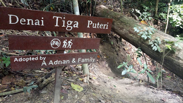
Yes! The final signboard before reaching the peak!
Take the right direction, and you'll be on your way to Denai Tiga Puteri peak!
From this peak, you may see a long stretch of NKVE highway.
Well, how many trails or hills offer this view?
*the scenic peak - NKVE highway view*
After resting on the peak for a good 30 minutes, we decided to descend before the it gets too hot.
Back at the 500m junction, you need to ensure you take the correct path to go back to where you started.
Going left will lead you to Unity path, heading towards Section 10 exit (which is where we parked our car).
Going right will also lead you to Unity path, but this direction heading towards Section 9 exit.
It took us less than 1 hour to reach the exit as this time we've identified the route and we got out easily.
Summary of the hike:-
1. Easy hike. Last 500m is the hardest.
2. Bring sufficient water. Though it is easy but the trail is quite long and time consuming. Make sure you're well-hydrated during the hike.
3. Very limited parking space. Be sure to get there early to secure a parking spot.
Till next hike, ciaoz!!


